

Insight
Digital collaboration
More efficient

The power of Clearly.Projects
The online collaboration platform and environmental management tool for projects in the living environment
Clearly.Projects is used to provide visual insight, prevent information loss, organize projects smarter and optimize digital collaboration within the (construction) team and with the client.

.png)
Collaborate in one platform
Various disciplines work in one user-friendly platform, are aware of each other's work and have access to the most up-to-date state of affairs.
We structure digital work processes for permits, research, land acquisition, VTWs, customer requirements, interfaces and stakeholder management. Clearly.Projects processes these processes and information on the map and can exchange data with external software such as Relatics, ArcGIS, the Bouwapp, Omniom and many others.

Digitize work processes
Example of an issue management process:
1. An Engineer identifies an issue between the design and a gas line.
The issue process is activated on the card at the touch of a button.
2. The Engineer fills in the predefined characteristics in the item and the issue turns orange on the map.
3. The responsible technical manager will receive a task and deadline for resolving this interface. He/she can invite any other team members to think along and share responsibility.
4. Once the required data has been entered, the solution can be assessed and if approved, the issue will turn green on the map.


Distinctive extras
● Where GIS stops, Clearly goes one step further
● On your laptop, iPad or mobile.
● Standardized where possible, customization where necessary.
● The online collaboration platform for the project team.
● Free unlimited users

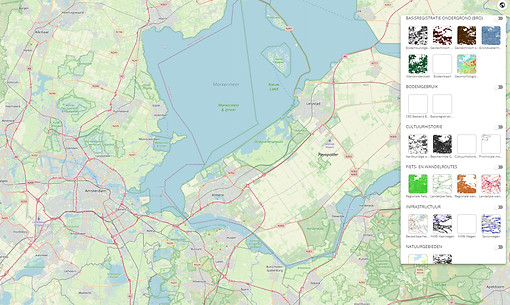

Map layers available by default
We can convert any project-specific dataset into a valuable map layer.
-
BRK & BAG
-
Cultural history
-
Natural areas
-
Archaeology
-
Soil use
-
Cycling and walking routes
-
Infrastructure
-
Spatial plans
-
Public Law Restrictions
-
Water board data
-
Security regions
-
High resolution aerial photo PDOK (7.5 cm)
-
General elevation map of the Netherlands (AHN 3)
-
CBS Postcode Statistics and Square Statistics


Showcases


What our customers say

Ellen de Waard
Clearly.Projects helps me as environmental manager at Nobian to properly facilitate our project management. It has increased our engagement with stakeholders and we can more effectively carry out our promise for a more sustainable future.


Mathilde Palma
Thanks to Clearly.Projects, I have insight, overview, and control over my project. Thanks to this platform, I've had all stakeholders in sight from the beginning. This way, I know better what's going on, I keep control over the process and progress.


Wouter de Noo
Working with Future Insight on the development and use of Clearly.Projects is inspiring and provides a system that allows us to better control the many aspects of environmental management on our projects and to measure our performance properly.